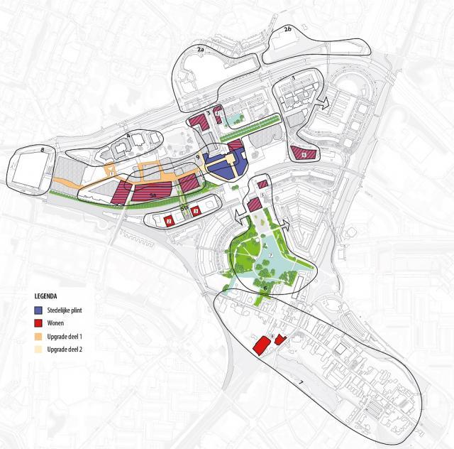
Downtown projects

Explanation card
- Red: Living
- Purple: Urban plinth:
- Commercial/social facilities
- Retail
- Hospitality
- Culture
- Care/education
- Exercise and Sports
- Yellow: Work
- Green: Public space: Green and water
- Orange: Public space: Squares and routes
With the city map we take you along the projects in the different sub-areas in the city centre of Zoetermeer. With the help of the different colours per theme, you get a good overview of what is happening in the city centre and where we are developing the city centre towards. With all projects we look back to the past, but especially to the future.
Learn more
You can read information about the different themes on the website Binnenstad Zoetermeer | Theme maps The themes are also described in detail in the Inner City Vision 2040 under chapter 1.4 Thematic maps.
Below you will find all information per project. On the website of the city centre, www.binnenstad-zoetermeer.nl , you will find extensive information about the projects with background information and news about the latest status.
- Sub-area 1: Cadenza 2
- Sub-area 3: Luxemburglaan 2-10
- Sub-area 5b: Engelandlaan 140
- Sub-area 5b: Engelandlaan 270
- Sub-area 6a: Redevelopment of Markt 10 and surroundings | Temporary filling of 'Gap in the Market'
- Sub-area 6b: Central Park
- Sub-area 7: Redevelopment of Delftsewallen
